Flooding
Level 2 of 4 flash flood risk for Florida and Georgia Tuesday, Nov. 17
By Ryan Hall, Y'all Weather Desk · Published · Updated
Written by our automated news desk from National Weather Service data.
What's new: Level 2 area now covers Florida and Georgia

Key points
- Where: Florida and Georgia, including Florida's Atlantic coast.
- When: 7 AM ET Tuesday, Nov. 17, through Wednesday morning. Level 2 continues for Florida's east coast Wednesday, Nov. 18.
- What: Heavy bands of rain and thunderstorms. Totals of 3 to 5 inches or more are possible in the heaviest spots, with rain rates of 2 to 3 inches an hour in the strongest storms.
- What it means: Scattered flash flooding is possible, including in cities along I-95. Plan for slow, wet drives both days.
A Level 2 of 4 (Slight) flash flood risk covers Florida and Georgia from 7 AM ET Tuesday, Nov. 17, to 7 AM ET Wednesday, Nov. 18. Bands of storms could drop 3 to 5 inches of rain or more in the wettest spots along Florida's Atlantic coast, and Level 2 stays up for Florida's east coast on Wednesday. That adds up to scattered flash flooding, not a widespread flood. Today, Monday, no flash flood risk is outlined anywhere in the country.
Where the flash flood risk sets up
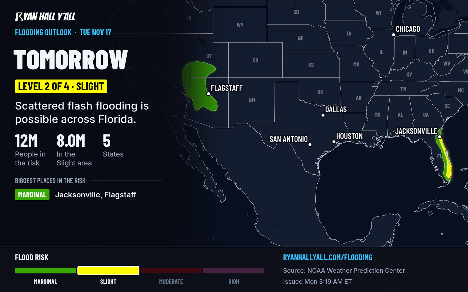
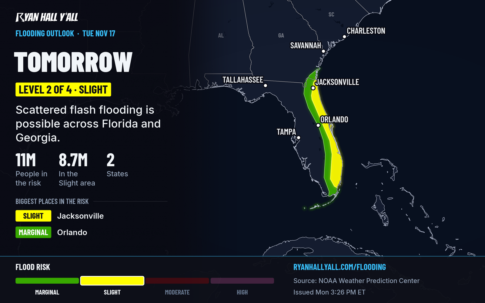
The Level 2 area now takes in Florida and Georgia. An earlier update pushed the northern edge of the Florida risk to the Georgia line based on newer high-resolution computer models.
A disturbance in the upper atmosphere will move toward Florida on Tuesday, slow down and start to cut off from the main flow. Near the ground, winds blow in from the east off the Atlantic, while winds higher up blow from the west. That tug of war squeezes air together along the coast and can set off bands of storms that rebuild over the same neighborhoods again and again, like cars driving the same stretch of road. The air is also loaded with moisture, so the strongest storms can rain very hard.
Why this is a Level 2 and not higher
Storm fuel is limited. CAPE, the measure of that fuel, tops out around 500 to 1,000 units, which is modest. The concern is how long the rain lasts. Bands that keep rebuilding over the same spots can stack up 3 to 5 inches or more, and one strong storm can put down 2 to 3 inches in an hour. That supports scattered flash flooding rather than a widespread event.
What happens Wednesday
Thunderstorm chances carry over from Tuesday into Wednesday, Nov. 18, as the disturbance keeps slowing down. Level 2 stays up for Florida's east coast, with a continued threat of scattered flash flooding, especially along the I-95 urban corridor. Totals of 3 to 5 inches remain possible in the wettest spots.
California also has a Level 2 on Wednesday, for central coastal California and the Bay Area, as a plume of Pacific moisture arrives. That is a separate setup, and the flash flood outlook has the details.
How sure we are
The multi-day rain event along Florida's east coast is well supported. Exactly which neighborhoods get the heaviest totals is not, because bands of storms are hard to pin down ahead of time. The risk area can still shift, so check the outlook again Tuesday morning.
What to do
- Give Tuesday and Wednesday drives extra time on I-95 and the coastal highways. Check the interstate driving outlook before you leave.
- Don't drive through water over the road. Turn around and find another route.
- Clear storm drains and gutters near your home today.
- Move cars out of low spots if your street or lot tends to hold water.
- Keep an eye on live warnings when the rain turns heavy. If a flash flood warning goes out for your area, move to higher ground. You can also sign up for free Y'all Alerts.
Bottom line
Florida and Georgia are under a Level 2 of 4 flash flood risk Tuesday, and Florida's east coast stays there Wednesday. Along Florida's east coast, expect two days of heavy, repeated rain with scattered flooding, and leave extra time on the road.
Explained: What the flash flood risk levels mean, from Level 1 to Level 4
More on Florida flooding, November 2026
Sources
- WPC Day 2 Excessive Rainfall Outlook, NOAA Weather Prediction Center, issued