Winter weather
Up to 23 inches of new snow in California's eastern Sierra since Wednesday
By Ryan Hall, Y'all Weather Desk · Published · Updated
Written by our automated news desk from National Weather Service data.
What's new: Added our storm reports map; warning details updated for this morning.
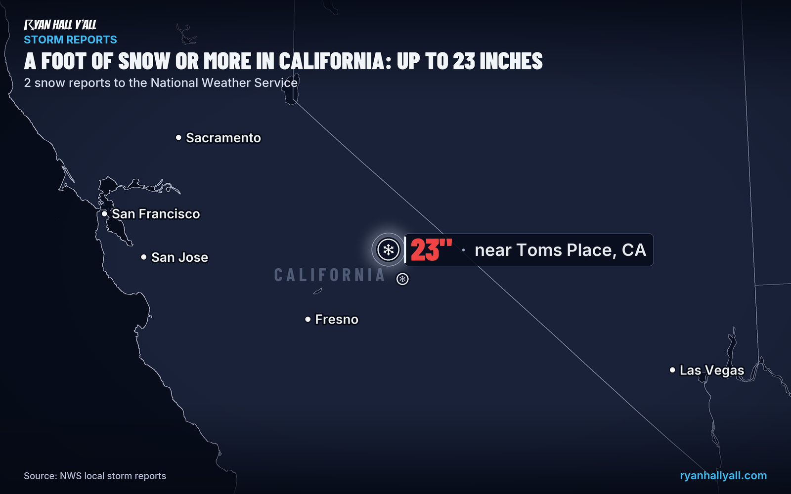
High-elevation sensors in California's eastern Sierra picked up up to 23 inches of new snow from Wednesday afternoon, Nov. 18, through Thursday evening, Nov. 19. Winter storm warnings for the Northern Sierra and the Lake Tahoe area run until 10 AM Pacific Friday, with a few more inches possible. A stronger storm Tuesday and Wednesday could bring a foot or more at pass levels in the northern Sierra.

Key points
- The snow isn't quite done. Winter storm warnings for the Northern Sierra above 4,000 feet, the Greater Lake Tahoe Area and Lassen-Eastern Plumas-Eastern Sierra Counties run until 10 AM Pacific this morning. The Northern Sierra warning calls for another 2 to 4 inches, locally up to 8 inches over the highest peaks. Up to 6 inches are possible along the Sierra crest near Tahoe, with gusts as high as
- Those totals are high-elevation numbers. Lower down, the Lassen-Eastern Plumas-Eastern Sierra Counties warning calls for up to 3 inches along CA-70 and west of US-395. The Tahoe Basin itself can pick up up to 2 inches.
- Check roads before you cross the passes today. Wind and fresh snow can slow things down, so carry chains and look at current conditions before you leave.
- More is coming. Our winter storm outlook shows a Marginal risk for the Sierra on Sunday, Nov. 22. A stronger storm Tuesday and Wednesday, Nov. 24 and 25, could bring a foot or more at pass levels in the northern Sierra. That one is still days out, so the details will shift.
Up to 23 inches of new snow fell at high elevations in California's eastern Sierra from Wednesday afternoon, Nov. 18, through Thursday evening, Nov. 19, according to preliminary reports. The Rock Creek Lakes sensor near Toms Place, at 9,700 feet, measured 23 inches. The South Lake sensor, at 9,600 feet, measured 22 inches. Both are in Inyo County.
What to know
- The snow isn't quite done. Winter storm warnings for the Northern Sierra above 4,000 feet, the Greater Lake Tahoe Area and Lassen-Eastern Plumas-Eastern Sierra Counties run until 10 AM Pacific this morning. The Northern Sierra warning calls for another 2 to 4 inches, locally up to 8 inches over the highest peaks. Up to 6 inches are possible along the Sierra crest near Tahoe, with gusts as high as 45 mph along the crest.
- Those totals are high-elevation numbers. Lower down, the Lassen-Eastern Plumas-Eastern Sierra Counties warning calls for up to 3 inches along CA-70 and west of US-395. The Tahoe Basin itself can pick up up to 2 inches.
- Check roads before you cross the passes today. Wind and fresh snow can slow things down, so carry chains and look at current conditions before you leave.
- More is coming. Our winter storm outlook shows a Marginal risk for the Sierra on Sunday, Nov. 22. A stronger storm Tuesday and Wednesday, Nov. 24 and 25, could bring a foot or more at pass levels in the northern Sierra. That one is still days out, so the details will shift.
See every active warning and the latest storm reports on our live pages.
Explained: Winter Storm Watch vs. Warning vs. Winter Weather Advisory: What Each Means
More on West winter weather, November 2026
Places in this story: Toms Place, CA; South Lake, CA
Sources
- NWS local storm reports (LSR), National Weather Service
- NWS Local Storm Reports (VEF), National Weather Service