Winter weather
Up to 35 inches of snow in the Sierra, more through 4 AM Friday
By Ryan Hall, Y'all Weather Desk · Published · Updated
Written by our automated news desk from National Weather Service data.
What's new: Added our storm reports map and clarified the Sierra Snow Lab total as a 48 hour storm total
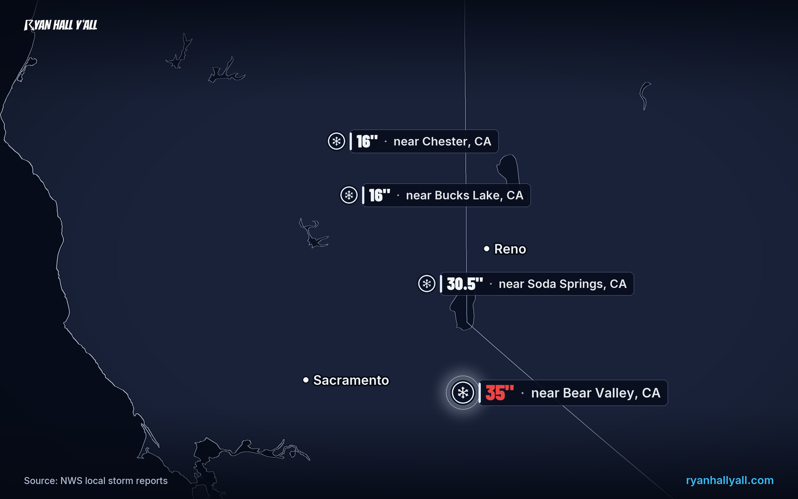
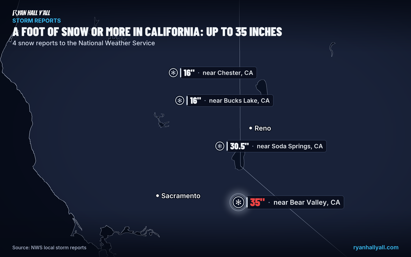
Up to 35 inches of snow has fallen in California's Sierra Nevada, and heavy snow continues around Lake Tahoe until 4 AM PST Friday. Another 8 to 14 inches is expected near lake level and 15 to 30 inches above 7,000 feet, with Interstate 80 and US-50 hazardous into Friday. The storm then moves into northern Utah and southeast Idaho on Friday afternoon and evening.
Key points
- More snow is coming. The Winter Storm Warning for the Lake Tahoe area calls for another 15 to 30 inches above 7,000 feet and 8 to 14 inches around lake level.
- Wind will blow it around. Gusts of 30 to 45 mph are expected in Truckee and the Tahoe communities, with ridgetop gusts as high as 100 mph.
- Travel stays rough. Blowing snow will keep Interstate 80 over Donner Summit and US-50 hazardous into early Friday afternoon. If you can wait, wait. If not, check the interstate outlook first. The heaviest snow tapers from west to east Friday morning into early afternoon, and a hard freeze follows Friday night.
- The storm moves east next. Snow intensifies across the Wasatch and Bear River ranges of northern Utah and southeast Idaho Friday afternoon and evening, with 1 to 2 feet in those mountains and 1 to 3 inches on urban benches. See our winter storm outlook for details.
Up to 35 inches of snow has fallen in California's Sierra Nevada, and heavy snow keeps falling around Lake Tahoe until 4 AM PST Friday. Bear Valley Ski Resort reported 35 inches in 24 hours, and Sierra Snow Lab south of Soda Springs has 30.5 inches over 48 hours, with 30.3 of it in the last 24. Those are reports from 7 AM PST Thursday, and they are preliminary.
What to know
- More snow is coming. The Winter Storm Warning for the Lake Tahoe area calls for another 15 to 30 inches above 7,000 feet and 8 to 14 inches around lake level.
- Wind will blow it around. Gusts of 30 to 45 mph are expected in Truckee and the Tahoe communities, with ridgetop gusts as high as 100 mph.
- Travel stays rough. Blowing snow will keep Interstate 80 over Donner Summit and US-50 hazardous into early Friday afternoon. If you can wait, wait. If not, check the interstate outlook first. The heaviest snow tapers from west to east Friday morning into early afternoon, and a hard freeze follows Friday night.
- The storm moves east next. Snow intensifies across the Wasatch and Bear River ranges of northern Utah and southeast Idaho Friday afternoon and evening, with 1 to 2 feet in those mountains and 1 to 3 inches on urban benches. See our winter storm outlook for details.
Every live snow report is on our storm reports page.
Explained: Winter Storm Watch vs. Warning vs. Winter Weather Advisory: What Each Means
More on West winter weather, November 2026
Places in this story: Bear Valley, CA; Soda Springs, CA; Chester, CA; Bucks Lake, CA; NE Chester, CA; NE Bucks Lake, CA
Sources
- NWS Local Storm Reports (STO), National Weather Service
- NWS local storm reports (LSR), National Weather Service
https://ryanhallyall.com/news/up-to-35-inches-of-snow-in-the-sierra-with-more-through-friday-morning