Forecasts
Wasatch snow Friday, Nov. 20: 1 to 2 feet in the mountains, squalls on I-15
By Ryan Hall, Y'all Weather Desk · Published
Written by our automated news desk from National Weather Service data.
What's new: Utah's Wasatch snow is now the next big winter story, the Sierra storm is winding down, and the Florida Level 4 of 4 flood risk is unchanged.
Key points
- Wasatch and Bear River ranges, Utah, Friday: 12 to 24 inches of snow, locally 25 to 30. Mountain driving gets rough, and the worst timing is Friday afternoon and evening.
- Salt Lake City to Ogden, Friday afternoon and evening: Brief, intense snow squalls can drop visibility fast on I-15 and I-80. Valley totals will be spotty.
- Lake Tahoe and the northern Sierra, tonight until 4 AM PST Friday: Snow tapers off. Winter Storm Warnings and a High avalanche danger in the backcountry stay in effect until then.
- Brevard County and the Space Coast, Florida, through Friday: Level 4 of 4 (High) flash flood risk on ground and rivers that are already overflowing. Another 1 to 3 inches of rain, locally more, is possible.
- Central Colorado, southeast Wyoming and far western Nebraska, Friday: Gusts of 35 to 45 mph and humidity near 20 to 25 percent make for elevated fire weather. Skip outdoor burning.
Wasatch snow Friday: 1 to 2 feet in the mountains, squalls on I-15 and I-80
Heavy snow arrives in Utah's Wasatch Range on Friday, Nov. 20, with 12 to 24 inches expected in the mountains above Salt Lake City and Ogden. A cold front crosses the area Friday afternoon and evening and can bring sudden snow squalls to I-15 and I-80. Tonight, the Sierra Nevada storm is easing, and flooding in eastern Florida continues at the top risk level.
Utah's Wasatch gets the next big snow
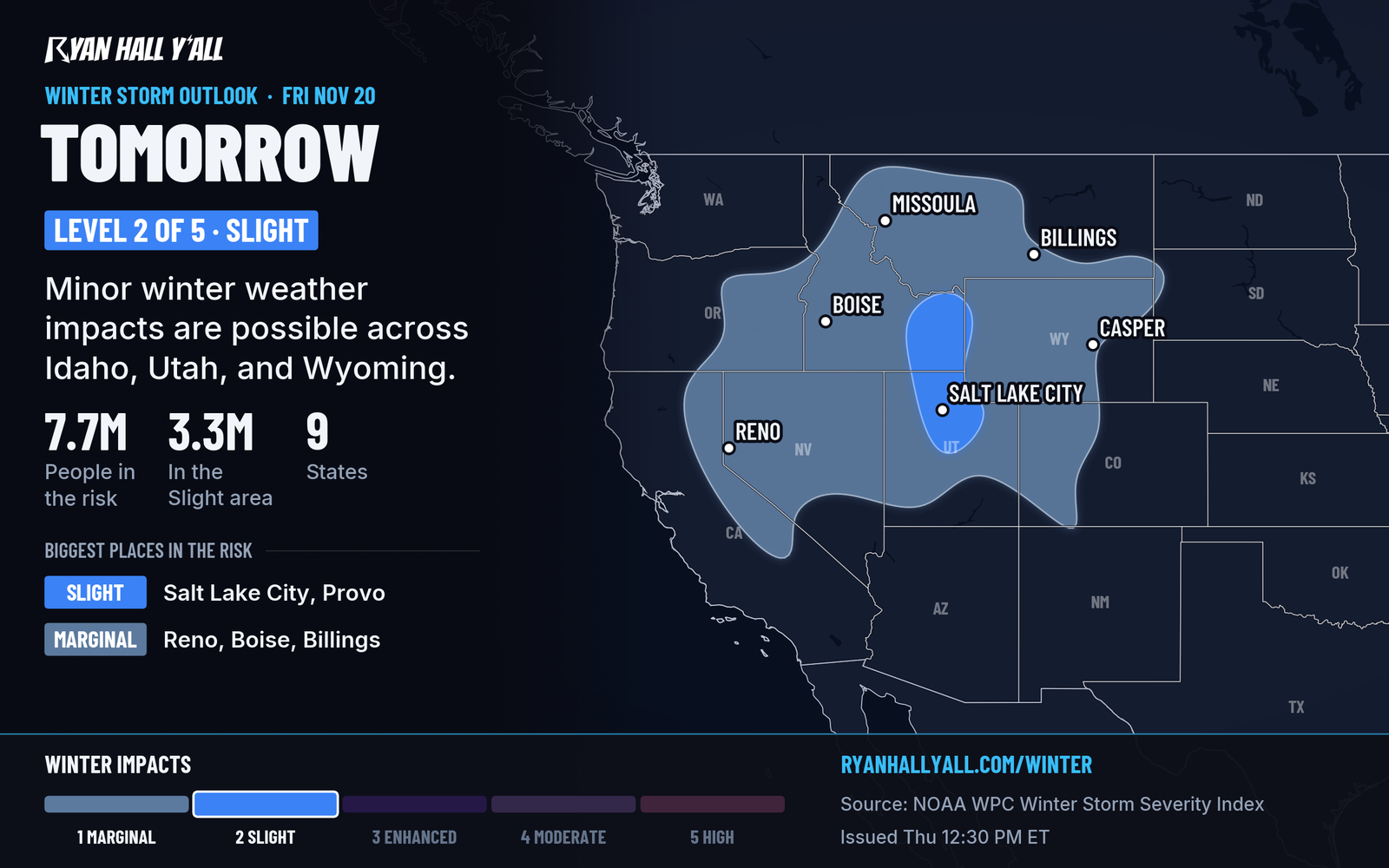
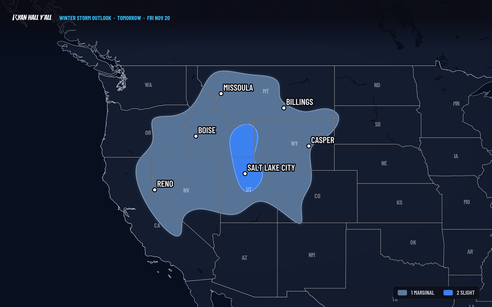
A Pacific storm and a strong cold front reach the Great Basin on Friday. Light to moderate snow starts in the morning. A second push comes with the front Friday afternoon and evening, followed by cold northwest wind that keeps the mountain snow going into Friday night. Our winter storm outlook has a slight risk of significant winter weather impacts across the Wasatch Range and northern Utah.
The mountains will get the most snow. Expect 12 to 24 inches in the Wasatch and Bear River ranges, with a few spots topping 25 to 30. Valleys, including the Salt Lake City area, will see less, and totals will vary from place to place. The bigger valley problem is the squalls. These short bursts of heavy snow and gusty wind can turn a dry road white in minutes.
If you drive I-15 or I-80 Friday afternoon or evening, leave extra room and expect slowdowns. Our interstate outlook has I-15 at Use Caution for cold and low visibility Friday. Moderate snow and gusty wind also reach parts of Nevada, Idaho, Montana, Wyoming and Colorado. The mountain snow part of this forecast is well supported. Exactly where the squalls set up is not, and that gets sorted out Friday.
The Sierra storm is winding down
The big early-season snow around Lake Tahoe is on its way out. The Winter Storm Warning for the Tahoe area runs until 4 AM PST Friday. It calls for up to 4 inches at lake level and up to 6 inches above 7,000 feet, with gusts around 30 mph in Truckee and Tahoe and up to 70 mph on ridgetops. The northern Sierra above 4,000 feet, including US-50 and I-80 passes, could still pick up another 8 to 12 inches, with up to 18 on the highest peaks. Snow rates of 1 to 2 inches per hour above 5,000 feet should fade after about 8 PM PST.
Backcountry avalanche danger is High until 4 AM PST Friday between Yuba Pass and Ebbetts Pass, so stay out of avalanche terrain. A Winter Weather Advisory for Reno, Carson City and Minden ends at 7 PM PST. Another advisory for northern and eastern Nevada runs until 4 PM PST Friday. In the Bay Area, a Coastal Flood Advisory runs until 11 AM Saturday, with up to 1.4 feet of water over low-lying shoreline along San Francisco and San Pablo bays.
An isolated severe storm with large hail, damaging wind or perhaps a brief tornado is possible in California's San Joaquin Valley this evening before the cold front passes. That is a Level 1 of 5 (Marginal) risk. No severe storms are expected anywhere Friday.
Florida flood risk holds at Level 4 of 4
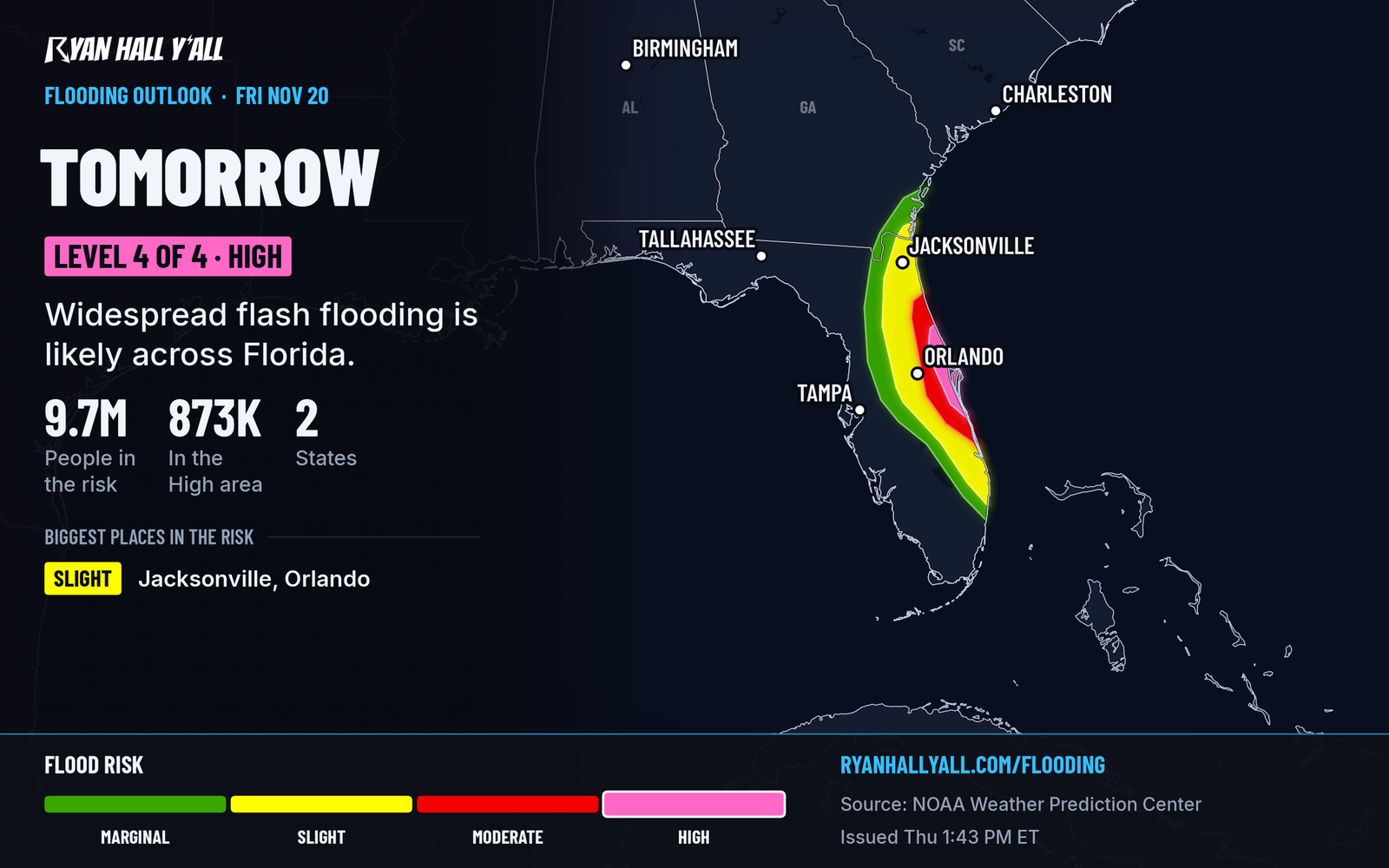
Nothing here has been upgraded since this afternoon. Coastal Volusia and Brevard counties, from Daytona Beach to Palm Bay, stay at Level 4 of 4 (High) through Friday, with a flash flood outlook Level 3 or higher over much of eastern and central Florida. The rain is steady rather than intense, but the ground has nowhere left to put it. Do not drive through water over a road. Heavy rain moves north toward Jacksonville Friday night and eases by early Saturday.
A coastal low forms off Florida on Friday and has a 30 percent chance of becoming a subtropical or tropical storm within 48 hours, and 60 percent within 7 days, per the tropics page. Either way, expect strong winds, rough surf and coastal flooding from Georgia to the Outer Banks, with a Level 2 of 4 flood risk for coastal Georgia, South Carolina and Florida on Saturday. For the river record and road closures, see our Florida flooding desk story.
Bottom line
Utah is the new snow story, with Friday afternoon and evening the worst time to be on I-15 or I-80 near Salt Lake City. Sierra warnings run out by 4 AM PST Friday, and the Florida flood risk stays at its highest level through Friday.
More on West winter weather, November 2026
Places in this story: Salt Lake City, UT
Sources
- WPC Day 2 Excessive Rainfall Outlook, NOAA Weather Prediction Center, issued
- Ryan Hall, Y'all winter storm outlook, day 2 (our own outlook), Ryan Hall, Y'all, issued
- WPC Winter Storm Severity Index (WSSI), NOAA Weather Prediction Center