Severe weather
Level 1 Hail Risk on the Texas Coast Near Houston Tuesday Night
By Ryan Hall, Y'all Weather Desk · Published
Written by our automated news desk from National Weather Service data.
Key points
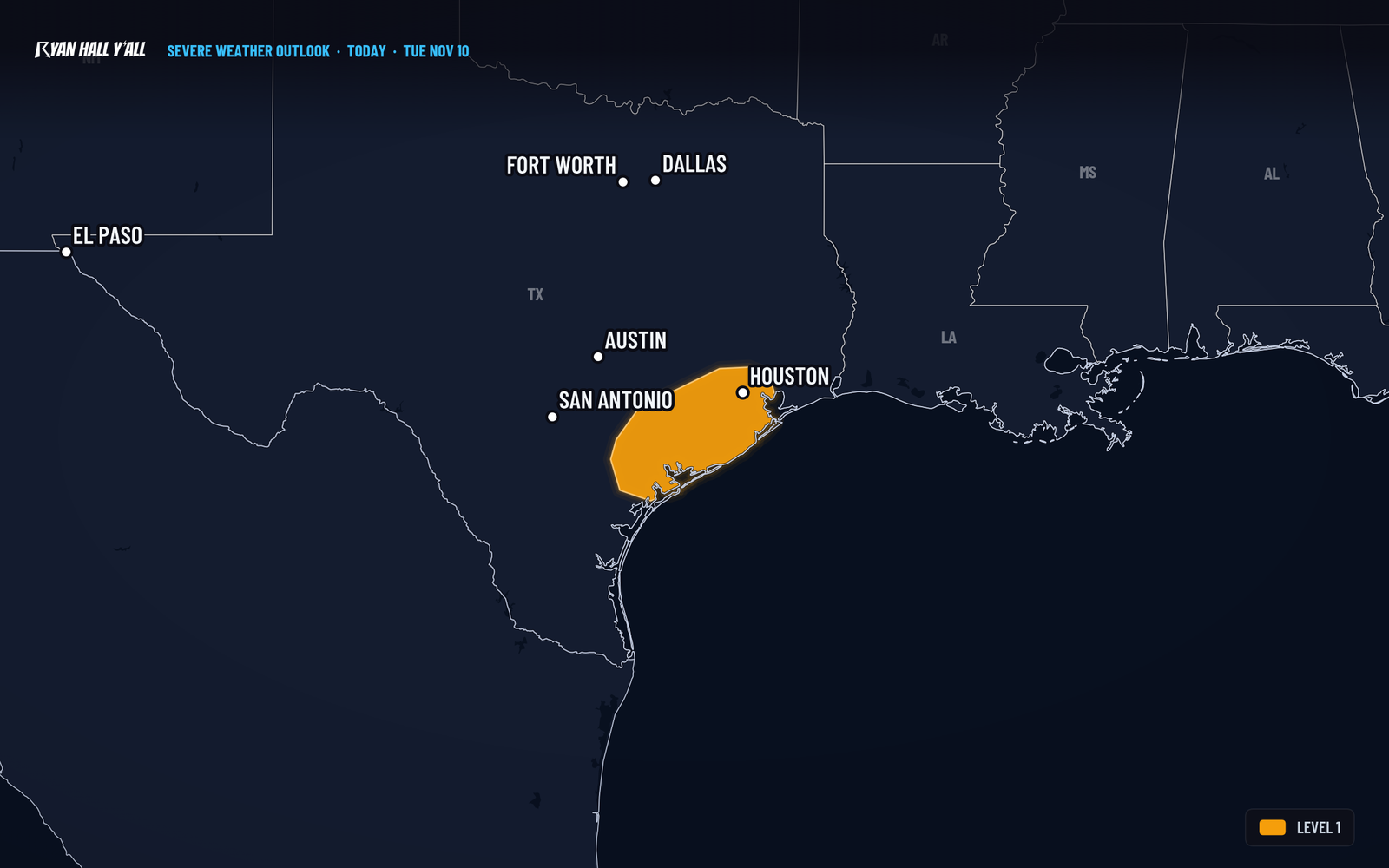
- Who is in it: About 6.7 million people live inside the outlined strip, which is a narrow band along the coast.
- Timing: Showers and a few storms are around this afternoon, and one could briefly throw some small hail. Storms should weaken late in the day. A disturbance drifting in from the Texas South Plains then helps storms increase again after 6 PM Central tonight.
- Impact: The chance of severe hail is about 5 percent at any one spot. Damaging wind and tornadoes are not outlined. If you park outside in Houston, a covered spot tonight is smart. Otherwise, keep an eye on the sky.
- Confidence: Pretty good that storms form, but only the most persistent ones should produce severe hail. Most storms will bring rain and lightning, not severe hail.
- Next up: Wednesday, Nov. 11, brings a Level 1 risk for isolated damaging gusts from western Kentucky and southern Indiana into northern Tennessee, including Nashville and Louisville.
A few thunderstorms along the middle and upper Texas coast could produce quarter-size hail today, Tuesday, Nov. 10, mainly after 6 PM Central. The area sits under a Level 1 of 5 (Marginal Risk) and includes Houston, Columbus, Cuero and Freeport. It is the only severe risk in the lower 48 today.
What to know
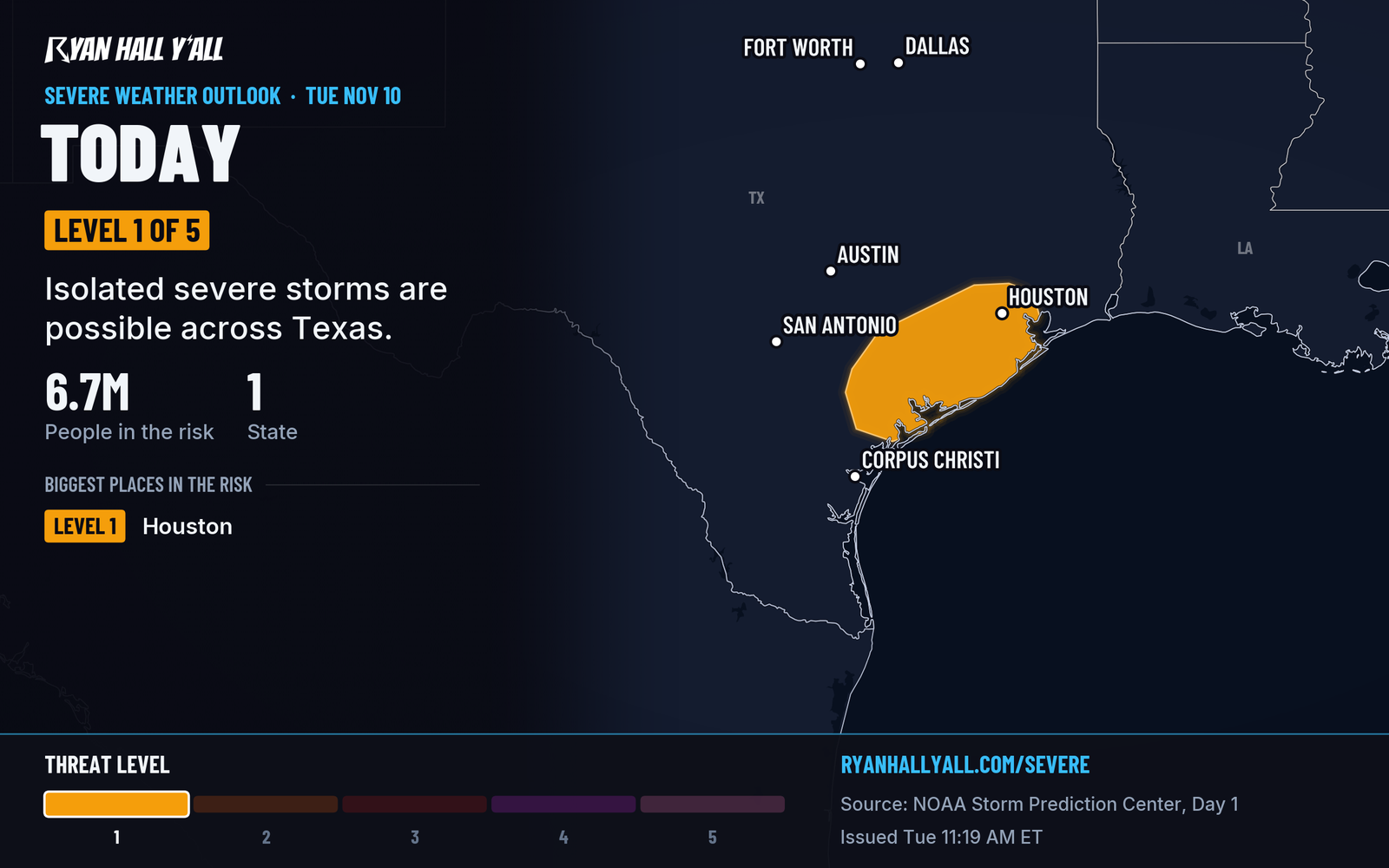
- Who is in it: About 6.7 million people live inside the outlined strip, which is a narrow band along the coast.
- Timing: Showers and a few storms are around this afternoon, and one could briefly throw some small hail. Storms should weaken late in the day. A disturbance drifting in from the Texas South Plains then helps storms increase again after 6 PM Central tonight.
- Impact: The chance of severe hail is about 5 percent at any one spot. Damaging wind and tornadoes are not outlined. If you park outside in Houston, a covered spot tonight is smart. Otherwise, keep an eye on the sky.
- Confidence: Pretty good that storms form, but only the most persistent ones should produce severe hail. Most storms will bring rain and lightning, not severe hail.
- Next up: Wednesday, Nov. 11, brings a Level 1 risk for isolated damaging gusts from western Kentucky and southern Indiana into northern Tennessee, including Nashville and Louisville.
Check the severe weather outlook for the latest updates through the night.
Explained: What the severe storm risk levels mean, Level 1 to Level 5
More on Ohio Valley severe weather, November 2026
Places in this story: Houston, TX; Nashville, TN; Louisville, KY; Cuero, TX; Corpus Christi, TX; Columbus, TX
Sources
- SPC Day 1 Convective Outlook, NOAA Storm Prediction Center, issued
https://ryanhallyall.com/news/level-1-hail-risk-on-the-texas-coast-near-houston-tuesday-night