Flooding
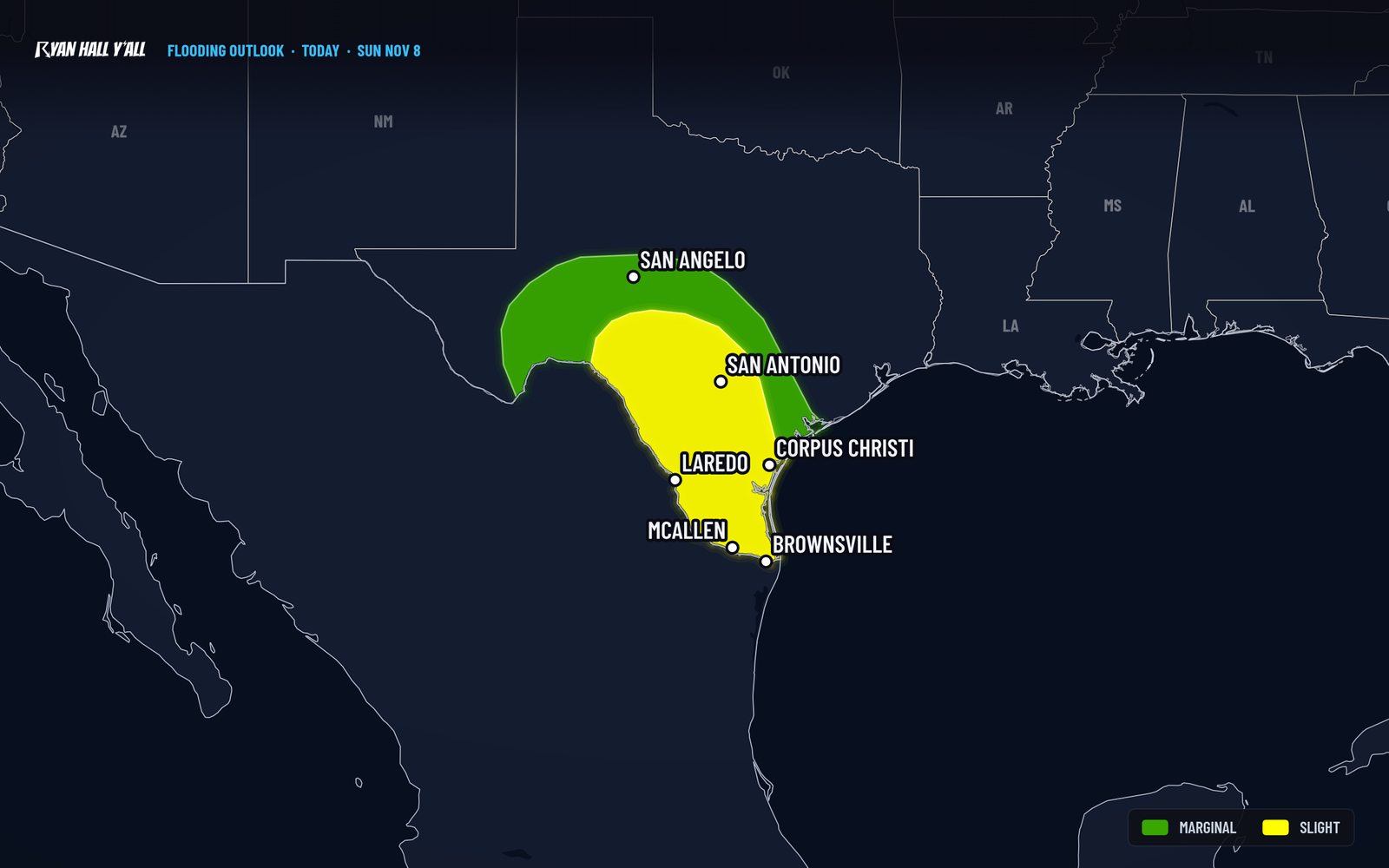
Level 2 flash flood risk for South Texas today through 6 AM Central Monday
By Ryan Hall, Y'all Weather Desk · Published · Updated
Written by our automated news desk from National Weather Service data.
Key points
- Where: South and south-central Texas, from San Antonio south to the Rio Grande Valley. The highest threat is from Laredo toward Corpus Christi.
- When: One round of heavy rain this morning, then another cluster of storms this afternoon. The best chance of flash flooding is late afternoon and evening, and storms re-fire tonight into early Monday.
- What: 3 to 6 inches over the full period, locally up to 8. Rain can fall at 1 to 2 inches an hour at its heaviest.
- What it means: Water over roads and quick rises in creeks and low spots are possible, especially from late afternoon through tonight. Severe storms are a small piece today (Level 1 of 5), because the storm fuel is low.
Updated 8:00 AM ET Sunday: Heaviest rain now centered on Laredo to Corpus Christi; totals raised to 3 to 6 inches.
A Level 2 of 4 (Slight) flash flood risk covers south-central and South Texas from 6 AM Central Sunday to 6 AM Central Monday, and the best chance of flooding is in South Texas from late afternoon through tonight. The heaviest rain is lined up between Laredo and Corpus Christi, with 3 to 6 inches possible across the region and up to 8 inches in a few spots.
Where the heaviest rain sets up
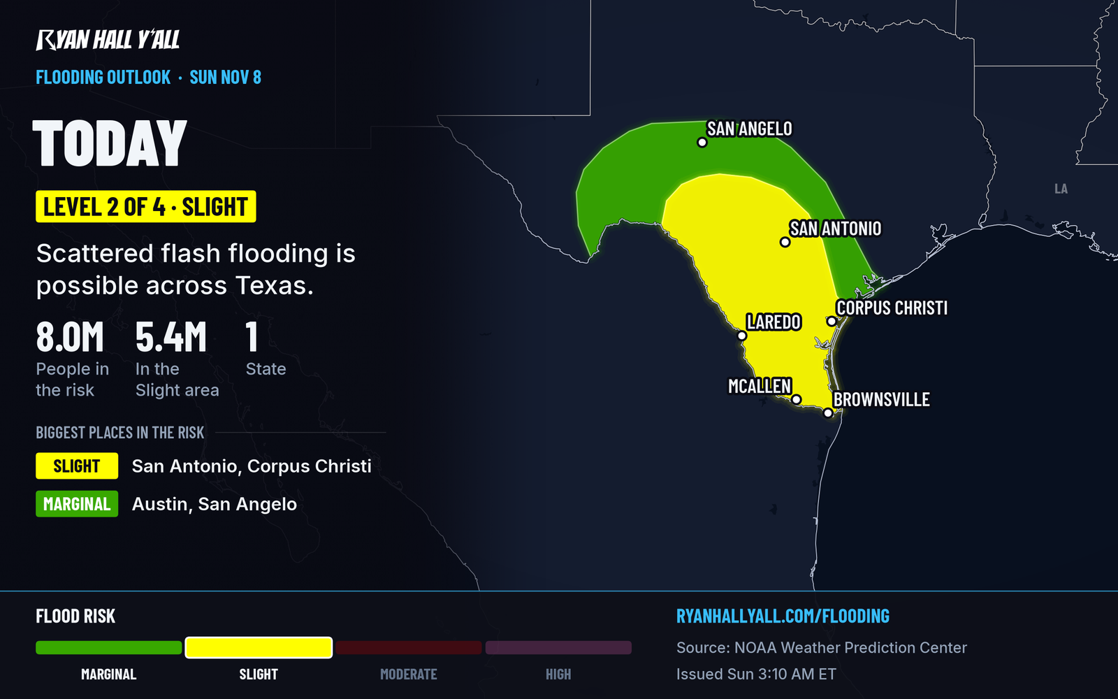
The Level 2 on this map is the official call for today. It means flash flooding is possible in places, not that every town floods.
A disturbance parked over northern Mexico is lifting the air over South Texas. Winds a little above the ground are carrying moisture north along the Rio Grande, and a surface trough stretching from the San Antonio area down toward Brownsville gives the rain a place to gather. The result is waves of showers and thunderstorms that keep passing over the same ground.
The odds of 3 inches or more are highest south of I-10, and the top threat is the stretch from Webb County (Laredo) over toward Corpus Christi. The ground can soak up a fair amount of rain here, but rain that keeps repeating for hours gets past that.
Timing: the highest threat runs from late afternoon through tonight
The early round this morning is the lead-in. By the afternoon, a cluster of storms should be centered from the eastern side of Webb County toward Corpus Christi. Rain of 2 to 4 inches, locally more, is possible through the afternoon and early evening.
A second push comes tonight. Winds feeding moisture north strengthen again overnight, and storms re-fire over the far southern tip of Texas into early Monday morning. That is why the risk runs through 6 AM Central Monday, not just through the daylight hours.
Monday: lighter, but on wet ground
The setup starts to break down Monday. A Level 1 of 4 (Marginal) risk covers South Texas, mostly south and southeast of I-10. Most spots should pick up another half inch to 1 inch. A narrow strip west and northwest of Corpus Christi down through the far South Texas coastal plain could see 2 to 4 inches, and that would fall on ground already soaked from today. We are watching that area closely.
The threat fades quickly after noon Central Monday. Tuesday has no flash flood risk outlined.
How sure are we
The rain is arriving about as expected. What is still up in the air is exactly where the heaviest bands park. Two nearby towns could see very different totals. Treat the 8-inch number as a high-end outcome for a few spots, not a typical total.
What to do
- Don't drive into water over the road. Late afternoon through tonight is the main risk, and you can't judge the depth in the dark. Turn around.
- Check conditions before trips on I-35 to Laredo and I-37 to Corpus Christi. Check the interstate driving outlook and active warnings before you leave.
- Move cars and gear out of low spots and clear storm drains near your home before the afternoon rain builds.
- Keep your phone charged with the sound on tonight. You can sign up for free Y'all Alerts too.
Our flash flood outlook page has the latest map.
Bottom line
South Texas has a Level 2 of 4 flash flood risk through 6 AM Central Monday, with the best chance of problems from Laredo to Corpus Christi from late afternoon through early Monday. Check conditions before driving, and stay off flooded roads.
Explained: What the flash flood risk levels mean, from Level 1 to Level 4
More on South Texas flooding, November 2026
Sources
- WPC Day 1 Excessive Rainfall Outlook, NOAA Weather Prediction Center, issued
https://ryanhallyall.com/news/level-2-flash-flood-risk-for-south-texas-on-sunday-rain-into-monday