Flooding
Level 2 flash flood risk in south Texas Sunday, rain lingers Monday
By Ryan Hall, Y'all Weather Desk · Published · Updated
Written by our automated news desk from National Weather Service data.
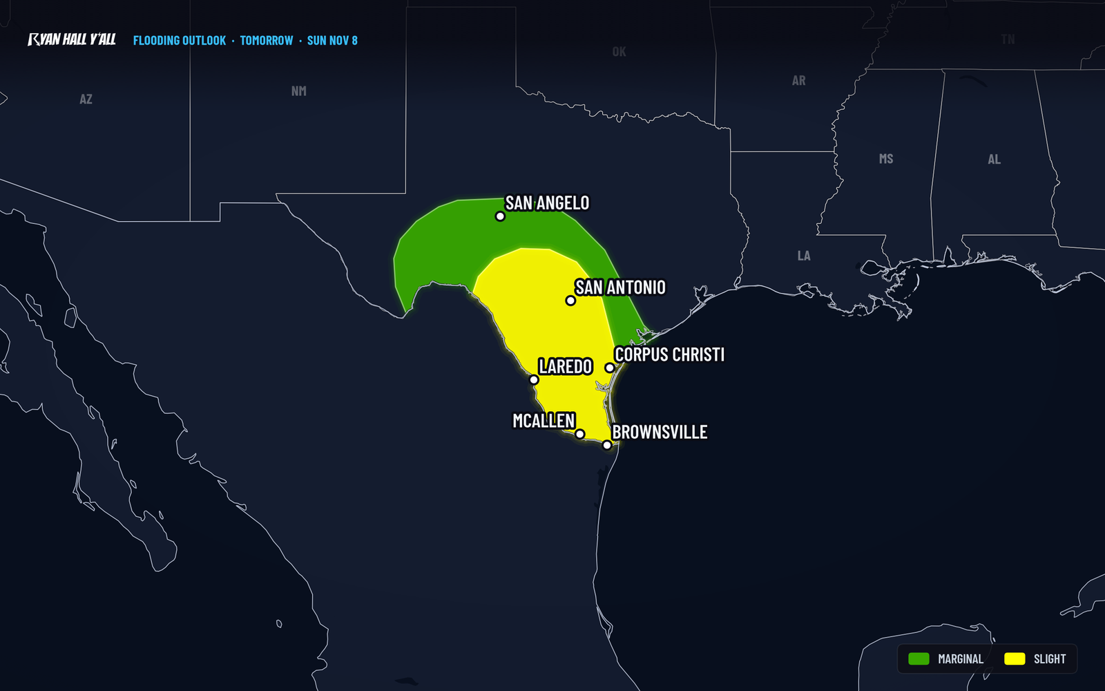
Key points
- Where: South Texas, including the Corpus Christi area, with heavy rain starting tonight along the Rio Grande from Del Rio to Eagle Pass. A little rain could spill into the western edge of the Texas Hill Country.
- When: Heavy rain develops late tonight, the Level 2 risk covers Sunday from 6 AM to 6 AM Central Monday, and showers fade from west to east on Monday.
- What: Locally 1 to 2 inches along the Rio Grande tonight, more heavy rain Sunday, and another 1 to 2 inches possible Monday, mostly over the same ground.
- What it means: Localized flash flooding in spots, mainly where rain runs off fast, like city streets. This is not a statewide washout.
Updated 10:00 PM ET Saturday: Overnight rain timing, Flood Watch details and Monday totals.
Parts of South Texas have a Level 2 of 4 (Slight) flash flood risk from 6 AM Sunday, November 8, through 6 AM Central Monday, after heavy rain builds overnight tonight. A Flood Watch is up around Corpus Christi through Monday morning, and 1 to 2 more inches of rain are possible Monday before drier air pushes in from the north.
Tonight: heavy rain builds along the Rio Grande
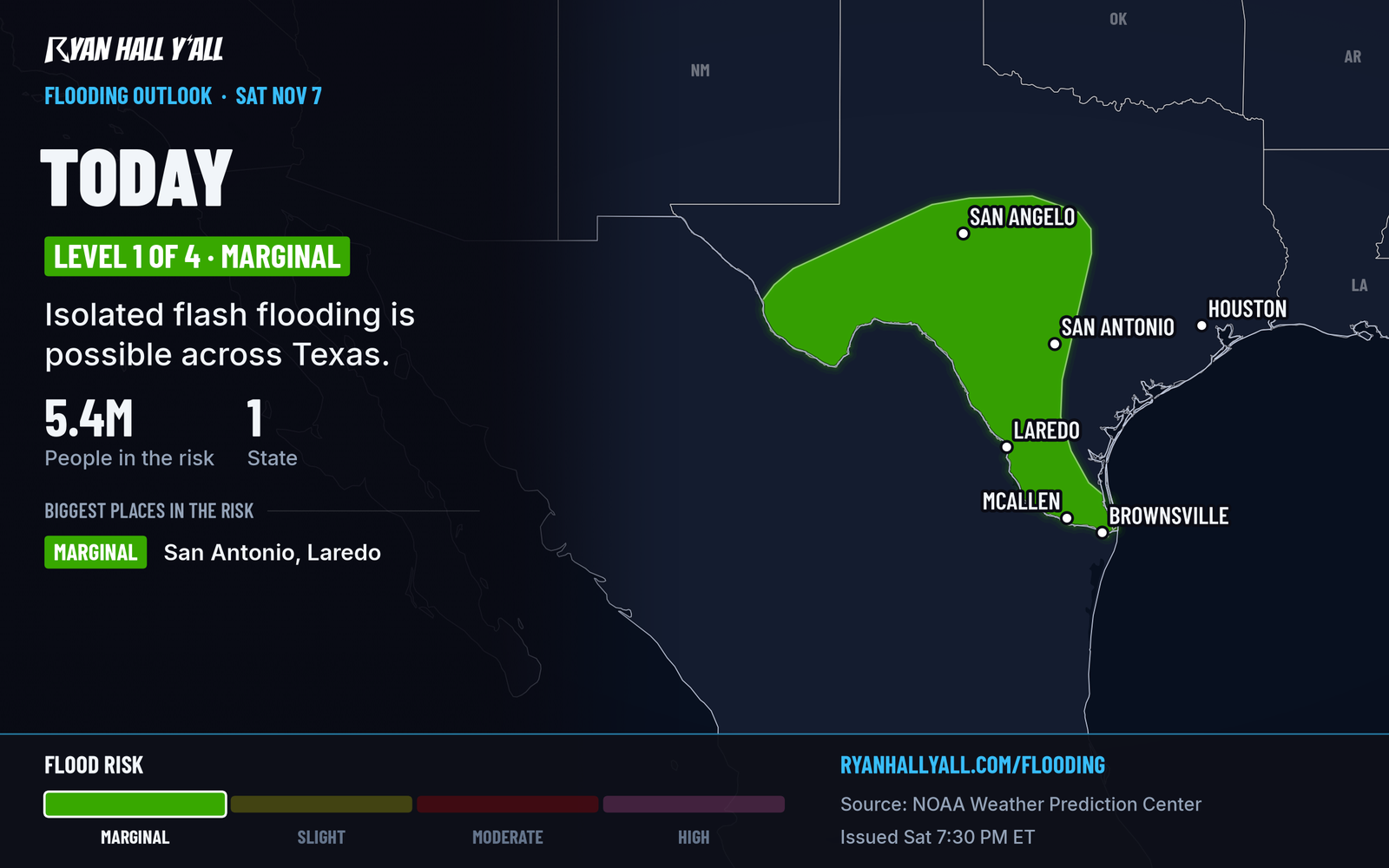
A disturbance high in the atmosphere is moving out of northwest Mexico and helping rain spread across west and south Texas. So far the rain has been scattered, and the storms have been fairly weak. That changes overnight.
Winds are funneling moist air up the Rio Grande, and storms should build quickly between Val Verde and Maverick counties and the counties next to them. That puts Del Rio and Eagle Pass in the zone for locally 1 to 2 inches of rain. Towns along the river are the likeliest places to see water on the streets.
Tonight only carries a Level 1 of 4 (Marginal) risk. The ground is fairly dry, so it takes a while for rain to start running off. The low-end flooding threat in south Texas begins after about 3 AM Central.
Sunday is the main day
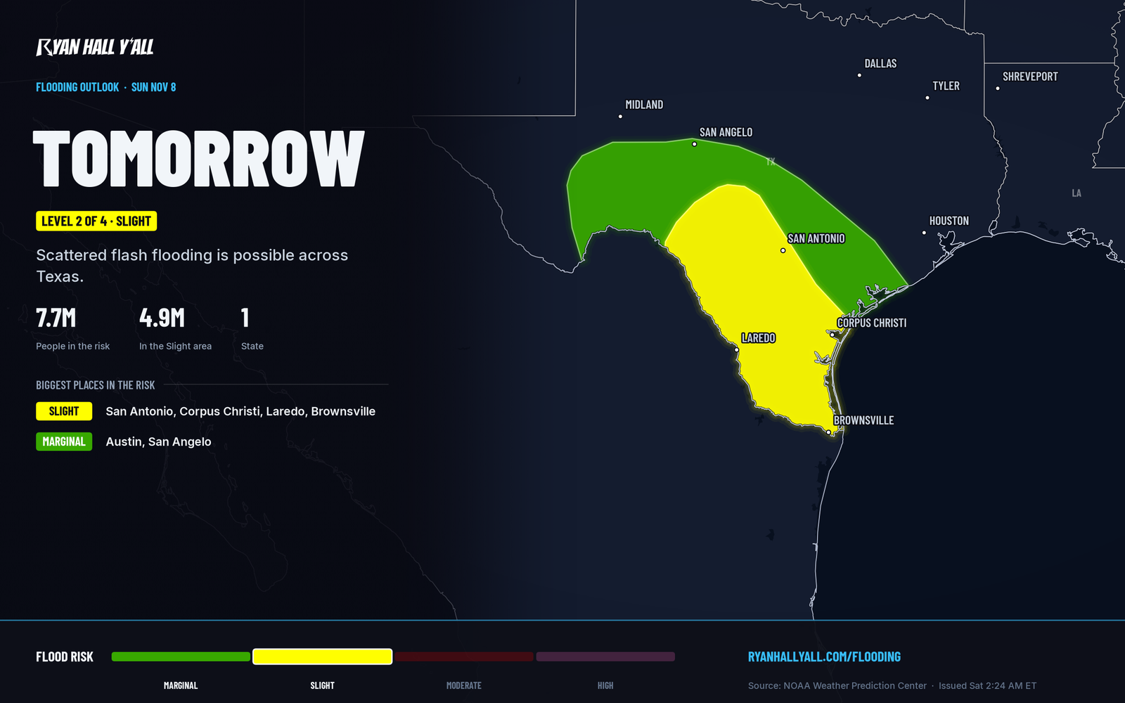
Sunday is when the Level 2 risk applies. Moist air flows in from the east and gets pushed up over higher ground. A strong stream of wind just above the surface keeps feeding it. That lets storms last longer and rain harder than they do tonight.
A Flood Watch is already up for part of south Texas, including Nueces, Kleberg, San Patricio, Aransas, Bee, Jim Wells, Duval, Live Oak and nearby counties. It runs through Monday morning.
How sure are we? The rain itself looks solid. The flooding is the less certain part. Dry soil soaks up the first round of rain, which is why this is a Level 2 and not higher. Once the ground fills, or if storms keep crossing the same neighborhoods, flooding gets more likely. Which neighborhoods get hit is not something we can pin down ahead of time.
No severe storms are expected Sunday.
Monday: leftover downpours, then drier air
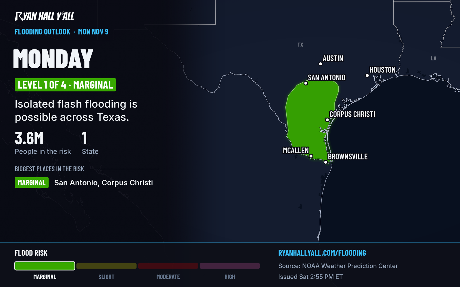
Scattered downpours with a few heavier cores should still be going across southern Texas early Monday. They weaken through the afternoon as drier air arrives from the north, and the rain ends from west to east. Another 1 to 2 inches is possible, mostly over the same area that gets rain Sunday. Wet ground means some flooding impacts could linger into Monday. The risk is Level 1 of 4 (Marginal).
The coast is the last place to dry out. If the heaviest rain stays right along the coast, sandier soils and fewer paved areas should hold flooding down. If it shifts west into the larger towns of far southern Texas, impacts go up.
What to do
- Don't drive into water over the road. That goes double after dark, when you can't tell how deep it is. Turn around and take another route.
- Check conditions before Sunday trips. Check the flash flood outlook before you leave, and our interstate driving outlook if you have a long drive.
- Know your low spots. If you park near a creek, a low-water crossing or an underpass that floods, move the car to higher ground before the rain peaks.
- Keep your phone ready. Warnings can pop up fast when storms sit over one area. You can sign up for free Y'all Alerts.
Bottom line
South Texas should plan for a wet Sunday with a chance of localized flash flooding, especially around Corpus Christi and along the Rio Grande. Showers taper off Monday as drier air takes over.
Explained: What the flash flood risk levels mean, from Level 1 to Level 4, Flood Advisory, Watch, Warning and Flash Flood Warning explained
More on South Texas flooding, November 2026
Places in this story: Corpus Christi, TX
Sources
- WPC Day 1 Excessive Rainfall Outlook, NOAA Weather Prediction Center
- WPC Day 2 Excessive Rainfall Outlook, NOAA Weather Prediction Center
- WPC Day 3 Excessive Rainfall Outlook, NOAA Weather Prediction Center
https://ryanhallyall.com/news/level-2-flash-flood-risk-in-southern-texas-sunday-rain-lingers-monday