Forecasts
South Texas heavy rain continues tonight, with 2 to 4 inches more possible Monday morning
By Ryan Hall, Y'all Weather Desk · Published
Written by our automated news desk from National Weather Service data.
What's new: The afternoon update points to a focused line of heavy rain that may redevelop Monday morning from Brownsville to Corpus Christi; the Monday risk stays Level 1 of 4, with an upgrade held back. New West Coast surf, Pacific Northwest rain and
Heavy rain is likely again in South Texas tonight, and a focused line may redevelop Monday morning from Brownsville to Corpus Christi on ground that is already soaked. Flood risk drops sharply after midday Monday. Coastal flooding and dangerous surf affect parts of the California coast through Tuesday, while rain becomes heaviest in Washington and Oregon later Monday and Monday night.
Key points
- South Texas, tonight through Monday midday: Storms are likely to redevelop overnight, then a line may set up near the coast Monday morning. Low-water crossings and small creeks are the trouble spots. Don't drive through water over the road.
- Southern California coast, through noon PST Tuesday: Minor to locally moderate coastal flooding at morning high tides, plus surf of 3 to 9 feet depending on the beach. Rip currents are dangerous.
- Washington and Oregon, Monday afternoon into Monday night: The heaviest rain of this stretch arrives, with snow on the higher Cascade passes and peaks.
- North-central Montana, until 8 PM MST tonight: A High Wind Warning covers gusts up to 65 mph around Havre and Great Falls. Secure loose items and watch for high-profile vehicle trouble.
- Most of the rest of the country: Quiet and mild. Monday looks beautiful from the Texas Panhandle through the Ohio Valley and the Southeast.
Heavy rain is likely again across South Texas tonight, but the new concern is a focused line that may redevelop Monday morning along the coast from Brownsville to Corpus Christi. Some spots could pick up another 2 to 4 inches on ground that is already soaked. The flood threat should fall off fast after about noon Central Monday.
South Texas: one more round, then it breaks down
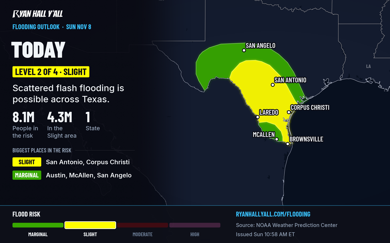
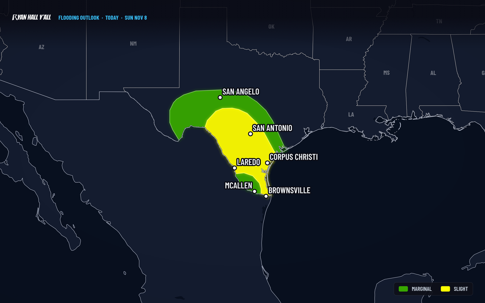
Tonight carries a Level 2 of 4 (Slight Risk) for flash flooding in South and south-central Texas. Some spots from east of Laredo to near Kingsville already have more than 5 inches, and we covered the totals in our Kingsville rain story. Fresh storms tonight land on that same wet ground, so it takes less rain to cause problems.
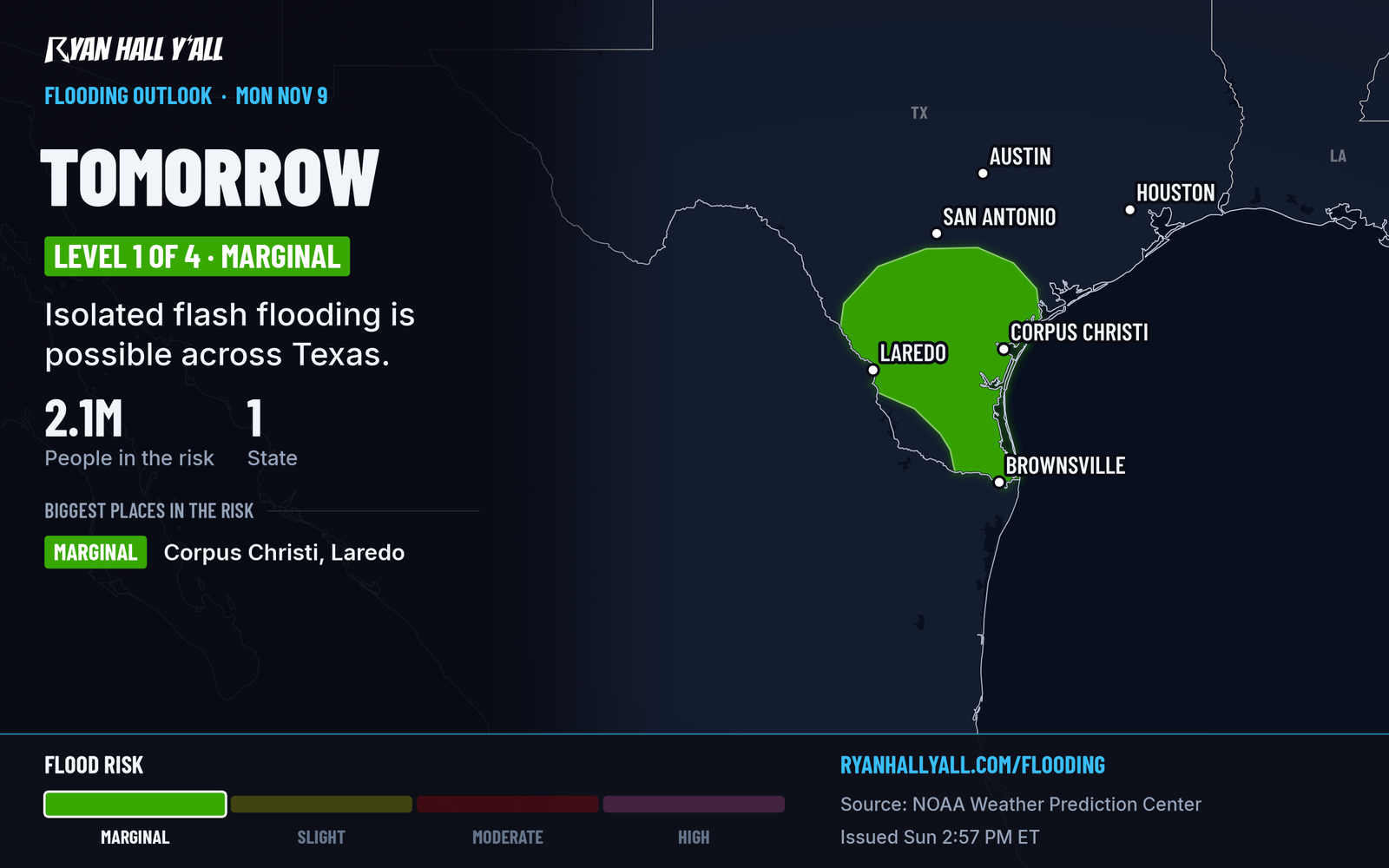
Monday is a Level 1 of 4 (Marginal Risk), mainly south and southeast of Interstate 10. Recent computer runs show a narrow, stubborn line of storms setting up along and just inland from the Gulf Coast from Brownsville to Corpus Christi Monday morning. Typical added rain is a half inch to an inch, but where storms keep crossing the same spots, 2 to 4 inches is possible. That scenario could justify a small upgrade, but an upgrade was held back for now.
After about noon Central Monday, the storm fuel wanes and winds turn from the east and northeast. Rain tapers off then, but creeks and low roads can stay high for hours afterward. A coastal flood advisory for Corpus Christi, Rockport and nearby coastal counties runs until 3 AM CST Tuesday for minor flooding.
What to do before bed: charge your phone, turn on alerts, and plan your Monday morning commute around the coast. If you're heading out from Brownsville to Corpus Christi, give yourself extra time and turn around if water covers the road. Our flash flood outlook updates through the night, and /warnings shows every active warning.
California coast: big surf and flooding at high tide
Coastal flood advisories run until noon PST Tuesday for San Diego, Orange, Ventura and Los Angeles County beaches, plus Catalina and the Malibu coast. Surf is 3 to 7 feet in San Diego and 4 to 6 feet in Los Angeles, and up to 6 to 9 feet in Ventura County on Monday. Morning high tides push water into low-lying beach roads and parking areas. Stay off jetties and rocks, and keep kids out of the water.
San Francisco Bay and San Pablo Bay have a separate advisory through Friday afternoon for up to 1.6 feet of water over low shoreline ground. A beach hazards statement for parts of the Pacific Coast calls for breaking waves of 12 to 16 feet through Monday evening, with sneaker waves. This fits the pattern in our jet stream story.
Pacific Northwest: rain ramps up Monday night
Periods of rain are moving into Washington and Oregon, and the heaviest and most widespread rain is expected later Monday and Monday night. Snow levels are high, so only the highest Cascade peaks and passes see real snow for now. There is a marginal winter weather risk in the Cascades Monday. If you're crossing a pass Monday night, check conditions before leaving.
Other things on the map
Tropical Storm Pena, with 46 mph winds, is moving west well south of Hawaii and is no threat to land. A disturbance off Nicaragua has a 20% chance of forming and is expected to bring heavy rain to parts of Central America through tonight. A minor geomagnetic storm is expected tonight, with a chance of a stronger one, so check our space page if skies are clear where you are. Our Nice Weather outlook rates Monday a beautiful day across a big stretch of the Southern Plains, Ohio Valley and Southeast.
Bottom line
South Texas gets one more round of heavy rain, and the Brownsville to Corpus Christi coast is the spot to watch Monday morning. The threat is expected to linger through midday, but the exact line placement is uncertain. The West Coast has surf and tide problems through Tuesday, and Washington and Oregon get their wettest stretch Monday night.
More on South Texas flooding, November 2026
Places in this story: Brownsville, TX; Corpus Christi, TX
Sources
- WPC Day 1 Excessive Rainfall Outlook, NOAA Weather Prediction Center, issued
- WPC Day 2 Excessive Rainfall Outlook, NOAA Weather Prediction Center, issued