Weather news
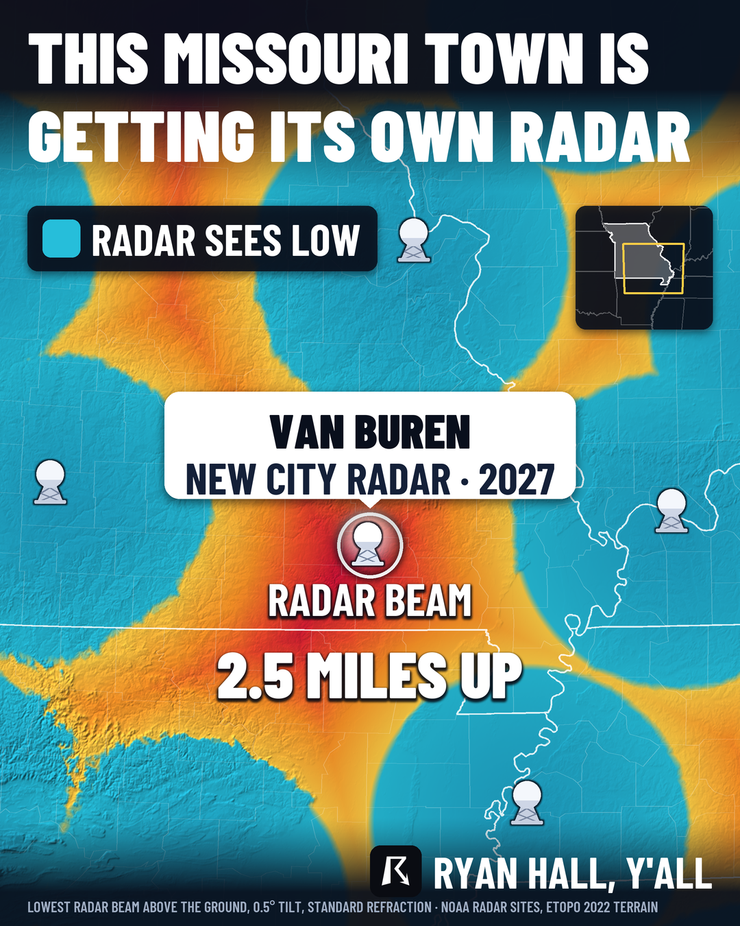
Van Buren, MO radar gap: nearest beams pass 2 to 2.6 miles up; new radar tentatively due in 2027
By Ryan Hall, Y'all Weather Desk · Published
Written by our automated news desk from National Weather Service data.
Key points
- Where: Van Buren, Missouri, and the surrounding area, where the closest radars overshoot the lowest part of a storm.
- What: A new city Doppler radar, funded with $2 million from the state and $396,000 from the Delta Regional Authority.
- When: Tentative install is spring to June 2027. That date can still move.
- How high: In parts of the area, nearby beams pass about 13,500 feet over the ground.
- What it means: The gain comes after the radar goes live, when it can provide a closer look at the lower part of a storm.
Van Buren, Missouri is getting its own Doppler radar, and our map of radar beam heights shows why it is needed. Around the town, the lowest beam from the nearest National Weather Service radars passes 2 to 2.6 miles above the ground. The new radar is tentatively set to go in between spring and June 2027.
Why the beam is too high over Van Buren
A weather radar sends out a beam that travels in nearly a straight line. The Earth curves away beneath it. The farther you are from the radar, the higher that beam is above your head.
Even the lowest tilt, half a degree above level, ends up a long way up by the time it reaches Van Buren. Around the town, the best of the nearby radars still has its lowest beam 2 to 2.6 miles over the ground. In some spots that works out to about 13,500 feet.
That matters because the beam can pass over the bottom of a storm, leaving part of the picture unseen.
How we built the map
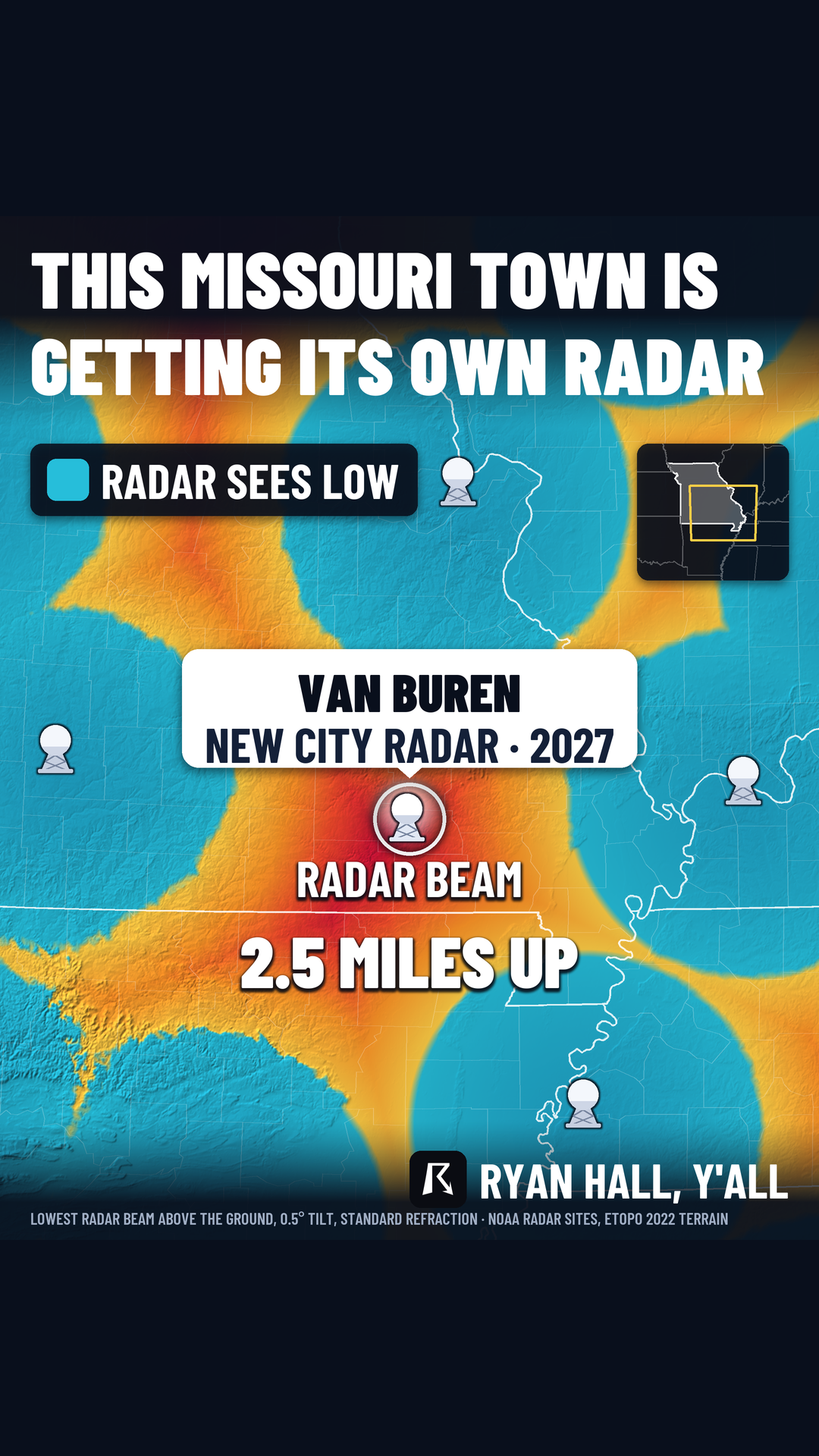
We did not guess at this. The map uses the beam height from every NEXRAD radar in range and keeps the lowest one at each spot, so each location shows its best available view. The calculation uses the 0.5 degree tilt, the center of the beam, and the way the atmosphere bends a radar beam slightly (the standard 4/3 Earth refraction setup). We laid it over NOAA's ETOPO 2022 terrain data at 15 arc-second resolution.
Using the lowest beam from every radar in range matters. It means the gap is not a case of looking at the wrong radar. Even the best of the existing ones leaves this area high and dry.
What the new radar changes
A radar sitting in Van Buren puts the beam close to the ground right over the town and its surroundings, instead of miles above it. That means the radar can provide a closer look at a storm's lower levels.
The money is already lined up. The state is putting in $2 million, and the Delta Regional Authority is adding $396,000. The install is tentative, spring to June 2027, so treat that as a target, not a promise.
One thing to keep straight: this is a city radar, not a replacement for the National Weather Service network. It adds a closer look where the big radars leave a gap.
What to do
- Don't wait on the radar. It is still months away, so keep using warnings and alerts the way you do now. Sign up for free Y'all Alerts and keep the live warnings page handy.
- Treat warnings as the call. If a warning is issued for your area, act on it.
- Check the outlook before storm days. Our severe storm outlooks go out to day 8, so you can see what is coming before you need the radar.
- Report what you see.
Bottom line
Van Buren is getting its own radar because the nearest ones look at the area from 2 to 2.6 miles up. The new one is tentatively due between spring and June 2027.
More on November 2026 weather