Weather news
Weakest polar vortex on record this early, measured Wednesday, Nov. 4
By Ryan Hall, Y'all Weather Desk · Published
Written by our automated news desk from National Weather Service data.
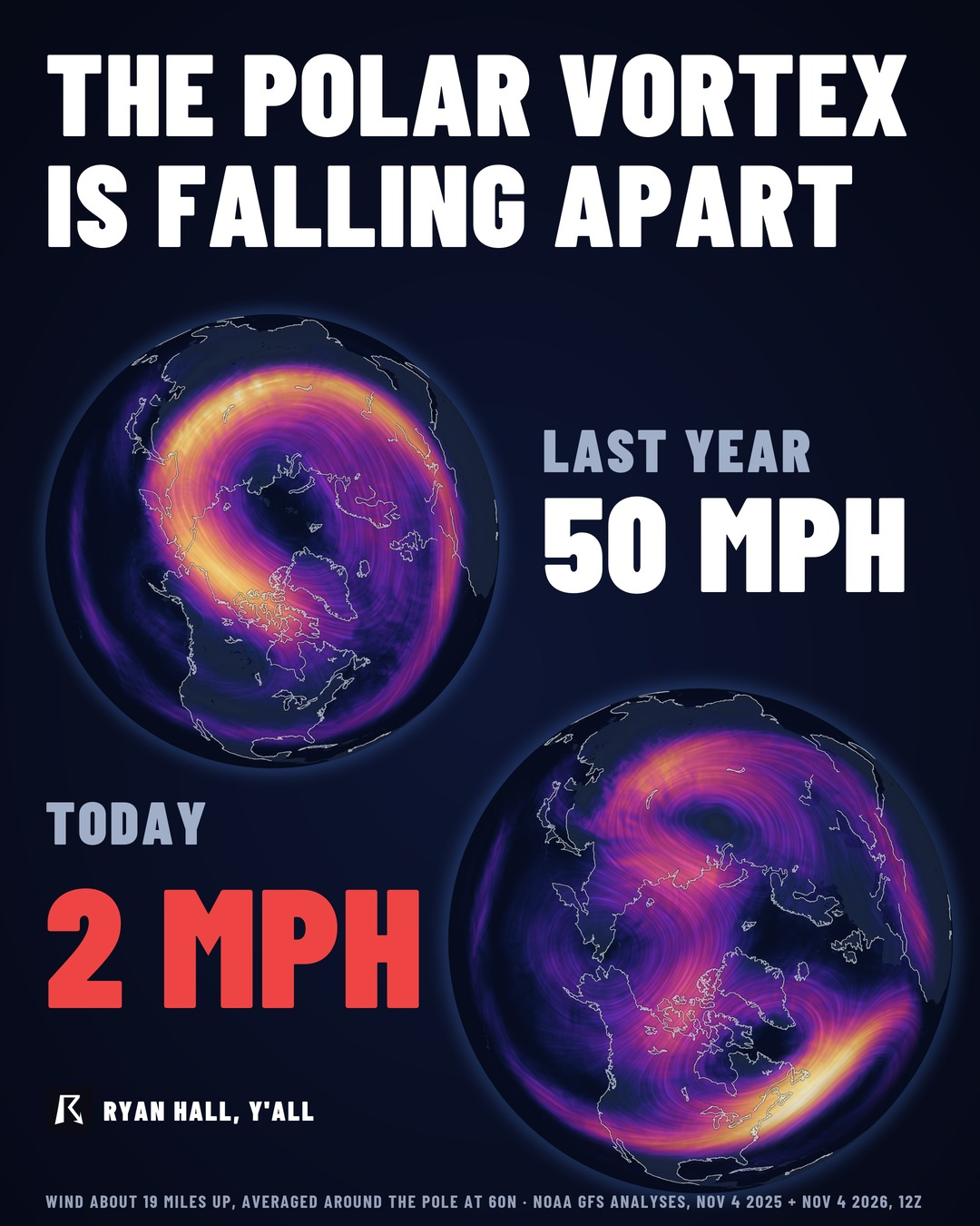
The winds of the stratospheric polar vortex have dropped to the weakest levels we have measured this early in the season. Wednesday's GFS analysis showed about 2 mph, against a normal of 55 mph for the date. A breakdown like this can send Arctic cold into the U.S. a few weeks later, but the timing and target are not yet known.
Key points
- What: The ring of fast winds circling the North Pole, high above the weather we live in, has nearly stalled.
- How weak: Wednesday's GFS analysis showed about 1.09 meters per second, or roughly 2 mph. The normal for the date is 55 mph.
- How rare: No day between October 1 and November 15 in the 1959 to 2025 record came in weaker than 7.47 meters per second.
- What it means: Arctic cold can reach the U.S. a few weeks later. Where and when is still unknown.
The stratospheric polar vortex is the weakest we have ever measured this early in the season, based on data through Wednesday, November 4. A vortex that falls apart like this can let Arctic cold spill into the U.S. a few weeks later. That is a window to watch, not a forecast for any one city yet.
What we measured
The polar vortex we are talking about sits in the stratosphere, well above the storms and fronts people see day to day. We tracked the average west-to-east wind at 10 hPa and 60 degrees north, a ring around the top of the world. In a normal early November that ring runs about 24.7 meters per second, or 55 mph.
Two separate model analyses show it collapsing. The GFS analysis from midday UTC Wednesday, November 4, came in at 1.09 meters per second, about 2 mph. The ECMWF analysis from Tuesday, November 3, came in at 3.4 meters per second, about 7.6 mph. Both are a tiny fraction of normal.
How it compares to the record books
We checked both numbers against ERA5, a long-running reconstruction of the atmosphere that goes back to 1959. For every day from October 1 through November 15, the weakest the vortex ever got was 7.47 meters per second, on November 15, 2009. Wednesday's GFS reading and Tuesday's ECMWF reading are both well under that.
For November 3 specifically, the previous weakest was 14.29 meters per second, back in 2004. That is still far above what we just measured.
One caution. The record comparison mixes live model analyses with a reanalysis dataset, so the exact decimals could shift a little. The size of the gap is large enough that the call holds: this is the weakest we have seen this early.
Why this matters for the lower 48
When the vortex breaks down like this, Arctic cold can move into the U.S. a few weeks later. That lag is why this is a heads-up and not a warning.
Here is how sure we are about each piece:
- Locked in: The vortex is historically weak right now. That is a measurement.
- Possible, not certain: Arctic cold can reach the U.S. a few weeks after a breakdown like this.
- Still up in the air: Which regions get the cold, how deep it goes, and whether it brings snow. We cannot say that from this data.
What to do
Nothing urgent today. This is a good time to prepare for cold weather:
- Check your heating system, and make sure pipes in unheated spaces are insulated.
- Pull out the cold-weather gear and car winter kit before you need it.
- Keep an eye on our winter storm outlook as the pattern develops.
- Sign up for free Y'all Alerts so you hear first if a cold outbreak takes shape.
Bottom line
The polar vortex is the weakest on record this early, about 2 mph on Wednesday, November 4 against a normal 55 mph. Arctic cold can reach the U.S. a few weeks later, but we do not yet know where or when.
| Value | Note | |
|---|---|---|
| GFS analysis, Nov 4 | 1.09 m/s | 2 mph |
| ECMWF HRES analysis, Nov 3 | 3.4 m/s | 7.6 mph |
| Lowest Oct 1 to Nov 15 in ERA5 (2009-11-15) | 7.47 m/s | Previous low for the whole window |
| Weakest Nov 3 in ERA5 (2004) | 14.29 m/s | Previous low for this date |
| Normal for the date | 24.7 m/s | 55 mph |
More on Weather records, November 2026
Sources
- GFS, 12Z run, NOAA National Centers for Environmental Prediction
- ECMWF, ECMWF
- Copernicus Climate Change Service ERA5, Copernicus Climate Change Service (ECMWF)
https://ryanhallyall.com/news/weakest-polar-vortex-on-record-this-early-measured-wednesday-nov-4