Forecasts
Wednesday storms in Nashville, Louisville, Indianapolis; Texas coast hail tonight
By Ryan Hall, Y'all Weather Desk · Published
Written by our automated news desk from National Weather Service data.
What's new: Wednesday's Level 1 risk for the lower Ohio and western Tennessee Valleys is now the next storm threat, with colder air, Great Lakes snow and Northeast rain on Thursday; the Houston-area hail risk continues tonight.
Key points
- Houston and the middle Texas coast, tonight: Showers and thunderstorms build this evening, and a few could drop quarter-size hail. Most people will just get rain and noise.
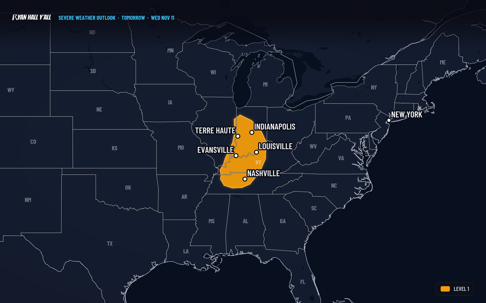
- Lower Ohio and western Tennessee Valleys, Wednesday late afternoon and evening: Scattered storms along a cold front, with isolated damaging gusts. A brief tornado is possible but unlikely, at 2%.
- Behind the front, Wednesday night into Thursday: Gusty northwest winds and falling temperatures spread across the Midwest and Ohio Valley.
- Michigan's Upper Peninsula, Thursday into Friday: Lake-effect snow, with several inches likely in the Huron Mountains.
- Mid-Atlantic and Northeast, Thursday: Rain spreads in as a coastal low strengthens offshore.
Wednesday storms from Nashville to Indianapolis, hail risk on the Texas coast tonight
A cold front will set off scattered thunderstorms across parts of Indiana, Kentucky, Tennessee and Illinois late Wednesday afternoon and evening, Nov. 11, including Nashville, Louisville, Evansville and Indianapolis. The Storm Prediction Center has a Level 1 of 5 (Marginal) risk in those areas, and the main worry is an isolated gust of 60 mph or more. Tonight, a Level 1 hail risk covers the Texas coast around Houston.
Wednesday's front: isolated damaging wind from Nashville to Indianapolis
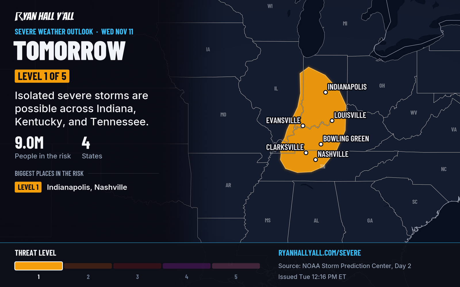
A weak low moves from Illinois toward eastern Ohio, and a cold front pushes southeast behind it. Afternoon sun and a little extra moisture should give the air some storm fuel, though not much. Storms should fire by early evening, and strong winds higher up could drag a few gusts to the ground.
This is a Level 1 day, so most of you will see a rain band and maybe a loud gust. If you're in the zone, check where your patio furniture and trash cans sit before dinner. Have a way to get alerts that works if you're asleep or in the car. Wednesday evening commutes through Nashville, Louisville and Indianapolis may be slow in thunderstorms.
Sign up for Y'all Alerts if you haven't, and watch the severe outlook for any upgrade.
Tonight on the Texas coast: hail is the only concern
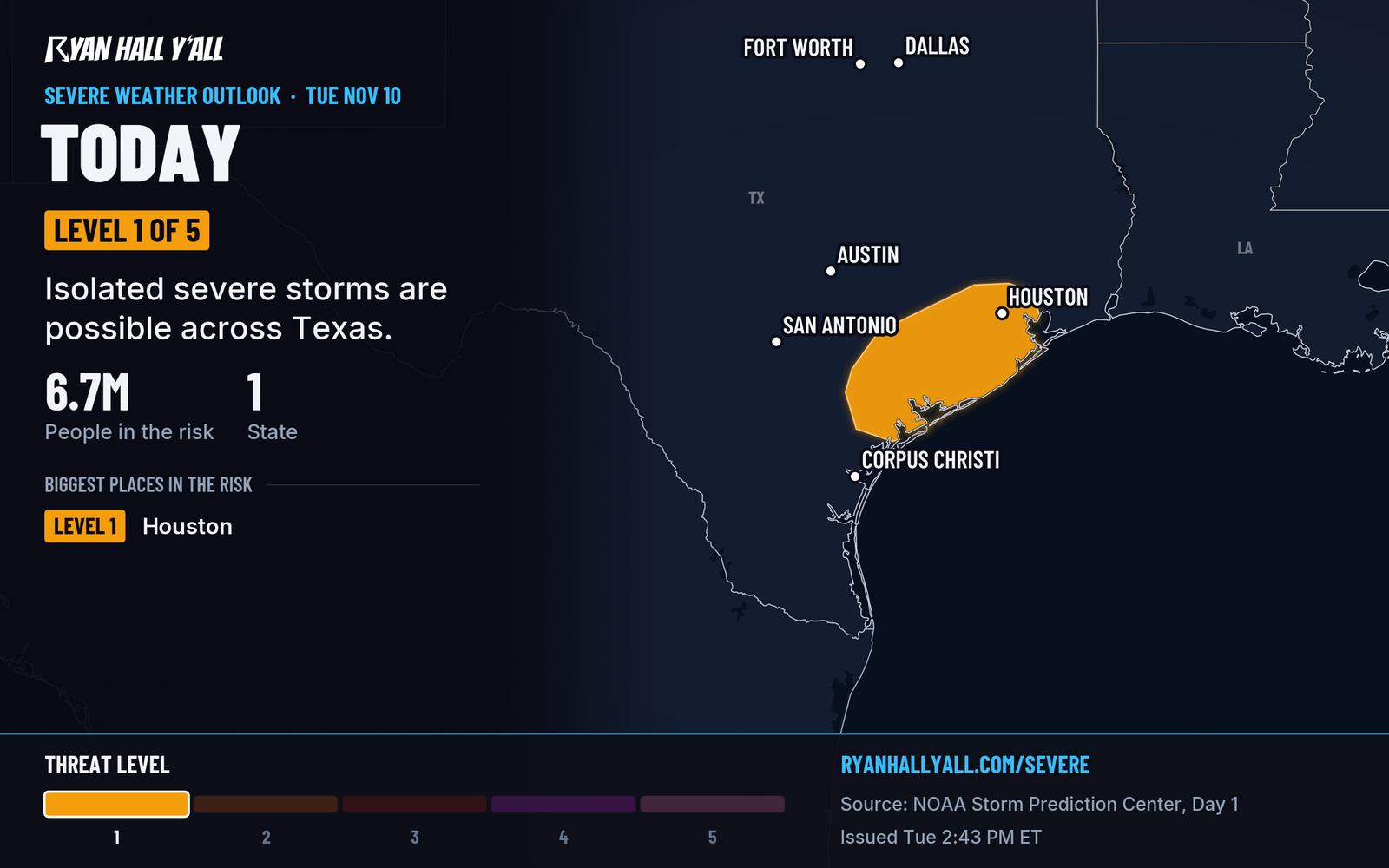
A disturbance drifting southeast across Texas runs into moist air along the coast this evening. The risk covers Houston, Freeport, Palacios and Columbus, and the threat is hail near 1 inch (quarter size) in an isolated storm. Park the car in the garage if it's convenient. We covered the setup earlier in Level 1 Hail Risk on the Texas Coast Near Houston Tuesday Night. No flash flooding is outlined.
The cold air and a messy Thursday
The front brings the coldest air of the season so far to much of the central and eastern U.S. by late week. Friday should run 5 to 15 degrees below average across the Mid-Atlantic and Northeast.
On Thursday, rain spreads across the Mid-Atlantic and Northeast as a coastal low forms and strengthens off the Mid-Atlantic coast that night. Expect winds picking up near the coast and a risk of minor coastal flooding at high tide.
In the Great Lakes, relatively warm lake water under cold air sets up lake-effect snow. The Upper Peninsula of Michigan has the best shot, with a better than 50% chance of 4 inches or more in the Huron Mountains through Friday evening. Our winter outlook has a Marginal risk of winter weather impacts for the upper Great Lakes Wednesday and Thursday. A narrow band could also reach northwest Indiana Thursday evening, possibly with wet snow if it falls hard enough.
Other warnings in effect tonight
- A Flood Watch for Mason County, Washington, runs from 7 PM PST tonight through Wednesday evening.
- The Llano River at Llano, Texas, is in moderate flood until Wednesday afternoon.
- A Frost Advisory covers Camden, Cumberland, Gloucester and Salem Counties in South Jersey from 1 AM to 9 AM EST Wednesday, with lows near 35. Cover tender plants.
- Coastal Flood Advisories remain for bayshore locations in San Francisco and for Southern Monterey Bay and the Big Sur Coast through 4 PM PST Friday.
The full list is on our warnings page.
Bottom line
Wednesday evening is a Level 1 day for the lower Ohio and western Tennessee Valleys, so a few strong gusts are possible. Tonight's hail threat near Houston is isolated. The bigger change is the cold air and the coastal low arriving Thursday.
More on South Texas severe weather, November 2026
Places in this story: Indianapolis, IN; Evansville, IN; Houston, TX
Sources
- SPC Day 1 Convective Outlook, NOAA Storm Prediction Center, issued
- SPC Day 2 Convective Outlook, NOAA Storm Prediction Center, issued